Landslides are among the most significant geological hazards affecting infrastructure, transportation networks, mining operations, and communities worldwide. Unstable slopes, heavy rainfall, earthquakes, and environmental changes can trigger sudden ground movement, causing severe damage and posing serious safety risks. As projects increasingly expand into challenging terrains, the need for reliable and continuous monitoring solutions has become essential.
Avacam addresses these challenges through advanced remote landslide monitoring solutions that combine industrial-grade devices, intelligent timelapse technology, and AI-powered analytics. By providing real-time terrain observation and early hazard detection, Avacam helps organizations improve safety, reduce risks, and protect critical infrastructure.
The Importance of Continuous Monitoring
Traditional landslide monitoring often relies on periodic inspections and manual surveys. While these methods provide valuable information, they may not capture rapid changes in terrain conditions or provide immediate warnings when risks increase.
Continuous monitoring allows engineers and project managers to track slope stability around the clock. With real-time access to terrain data, organizations can quickly identify changes, assess risks, and take preventive action before a small issue develops into a major disaster.
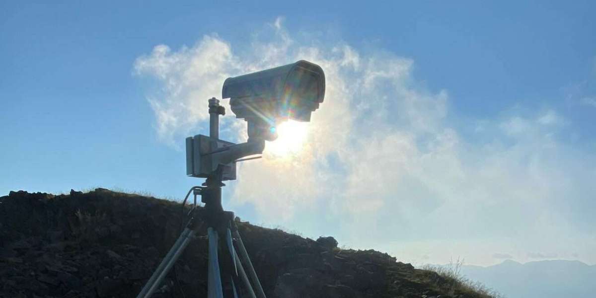
Industrial-Grade Devices for Reliable Performance
Remote monitoring systems must operate in some of the world's most demanding environments. Landslide-prone regions often experience harsh weather conditions, difficult terrain, and limited accessibility.
Avacam utilizes industrial-grade monitoring devices specifically designed for long-term operation in remote locations. These robust systems provide reliable performance under extreme conditions, ensuring uninterrupted monitoring and consistent data collection throughout the project lifecycle.
Intelligent Timelapse Technology
Timelapse monitoring plays a crucial role in understanding terrain behavior over time. Avacam's intelligent timelapse systems capture high-resolution images at regular intervals, creating a visual record of slope movement and environmental changes.
This technology allows experts to identify subtle shifts, erosion patterns, and progressive deformation that may indicate increasing instability. The resulting visual data provides valuable insights for geotechnical analysis, project reporting, and long-term risk assessment.
AI-Powered Analytics and Early Warnings
Modern landslide monitoring goes beyond simple observation. Avacam integrates AI-powered analytics to automatically analyze monitoring data and detect patterns associated with geological instability.
Advanced algorithms help identify unusual terrain movement and potential warning signs before they become critical. Automated